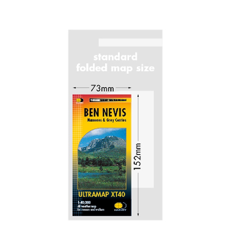
ULTRAMAP by HARVEY – BEN NEVIS XT40

£9.50

The Ultra map series from Harvey, idea for runners, walkers or if you just want to travel light. Using the magical 1:40,000 scale Harvey has perfected the ability to map a large area while clearly illustrating the relief of the land on a tough waterproof sheet that weights only 25g. Printed on both sides with an overlap that allows you to turn the sheet over without having to search for you position, everything has been made as simple and easy as possible while of course retaining the quality Harvey maps are known for.

This Ultra map covers Ben Nevis the highest summit in the land and has mapping at 1:20,000 including the bad visibility descent route for when the weather becomes more exciting. In addition 23 further Munros are covered plus 6 Corbetts.

Buy together with Snowdonia North and Lake District West in our Gift Box for comprehensive mapping of the National Three Peaks.

Categories: ,

Description

Available from Hergest Navigation | Pointing you in the right direction

Harvey XT40 maps are 2/3rds the folded size of conventional map making them easy to carry by hand or in a pocket.

The magic scale of 1:40,000 and the original Harvey mapping gives you all the detail you would expect and allows to get an overview and plan ahead.  The unique folding pattern allows you to open to either side of the sheet without the need to refold.

Ultra tough

Ultra light (each map weighs 25g)

Ultra compact

100% waterproof

ULTRAMAP by HARVEY – BEN NEVIS XT40

Reviews

There are no reviews yet.

Be the first to review “ULTRAMAP by HARVEY – BEN NEVIS XT40”

Your email address will not be published. Required fields are marked *